
![]()
Drone Monitoring
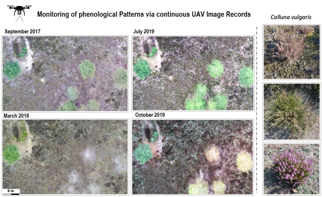
The observation of spatiotemporal changes of landscape development depends on natural processes of vegetation dynamics. For example, heathland is characterized by the different aspects of the seasonal phenology of heather, its companion species of lichens, mosses and grasses, and the proportion of litter. Each phase of a year is characterized by a specific colour spectrum of the image elements of a drone image. In it, in addition to the species spectrum, other characteristics of vitality, reproduction and distribution become visible.
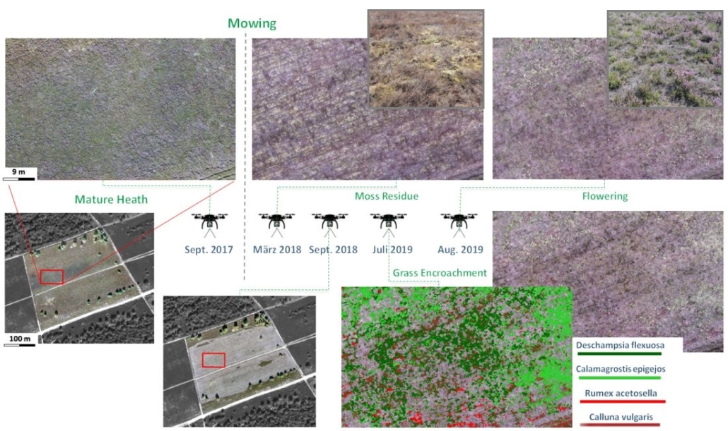
Spatiotemporal development trends following landscape management measures can also be traced via specific colour characteristics in drone images. For example, the appearance of a heather area changes drastically immediately after mowing. After cutting off old heather bushes, the natural development on a mown area can be traced. In addition to the resprouting of fresh green and the drying of moss in the stand, an increased flowering aspect can be observed in the broom heather. In addition, the spread of various herbaceous and grass species is observed, which are subject to changed site conditions after the area has been cleared.
images & text by Dr. Carsten Neumann