

![]()
Species and habitat information from the UAV drone campaign
RGB drone imagery provides high-resolution raster graphics in three colour channels (R-red, G-green, B-blue) and an information depth of 8-bit (gray values 0 to 255). This information can be used to train an algorithm to recognize different surface properties. For example, green vegetation can be distinguished from brown soil and dead wood based on the colour, but plant species per se can also be differentiated based on the colour information. For this purpose, the class of the respective type is assigned to each pixel and displayed on a map. These algorithms used to learn by themselves to identify certain species from the colour space – one speaks of machine learning.
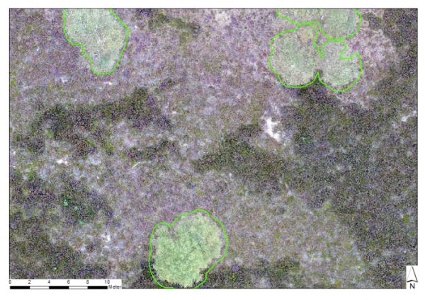
In addition to the colour information, drone images provide digital surface models (DOM) with a resolution of less than 20 cm. By intersecting this with a laser scan elevation model (LGB-Brandenburg), a so-called normalized surface model (nDOM) can be calculated. After the terrain height has been calculated out, only the object height, i. e. in the case of test field A the vegetation height, remains in the end. In this way, we could conclude that Calluna vulgaris reaches heights of five to 70 cm in this area, depending on its age.
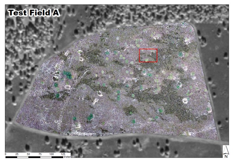
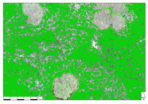
In total, three methods were developed for automatic and quantitative determination of the recorded drone images. Exemplary results are shown for a section of test field A (red rectangle above). In the first image, bottom left, a tree mask was produced that automatically detects the edges of larger trees so that a spatial separation of open land and forest habitats can be made. In the second image, we were able to separate individual heath plants from their surroundings using a self-learning algorithm. Each plant is recognized in the image pixel, designated and displayed with the different age, flowering and vitality stages (second image – green). In the final step (third image – stepless scale as above from zero to 70 cm), each heath plant is assigned a height from the nDOM. All three algorithms taken together allow to identify each individual Calluna plant from a drone image and to assign a height or colour information to it. The results can now be used in further steps to predict the spatial distribution of very specific properties such as the flowering aspect or the vitality status of the plants.
images & text by Dr. Carsten Neumann
Tree mask
Calluna vulgaris mask
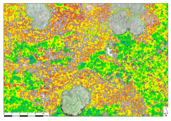
Plant height