


![]()
Spatial Nature Conservation Monitoring
Definition & Derivation of Scale Specific Biodiversity Indicators
Local research hypotheses and mapping
- Ecological restoration potentials: Assessment of undergrowth vegetation in forest areas.
- Phenological heterogeneity: Spatial mapping of fruit and flower proportions.
- Drought Impact: Spatial mapping and quantification of dead plant material.
- Calluna vulgaris plant structure: Quantification of life-cycles and growth status parameter.
- Impact of mowing: Mapping of potential regrowth capacity.
Regional habitat assessment and mapping
- Natura 2000 monitoring: Spectral conservation status assessment.
- Indicator species: Mapping the regional distribution of selected habitats.
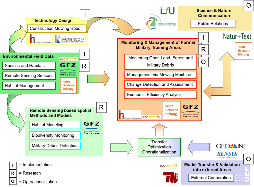
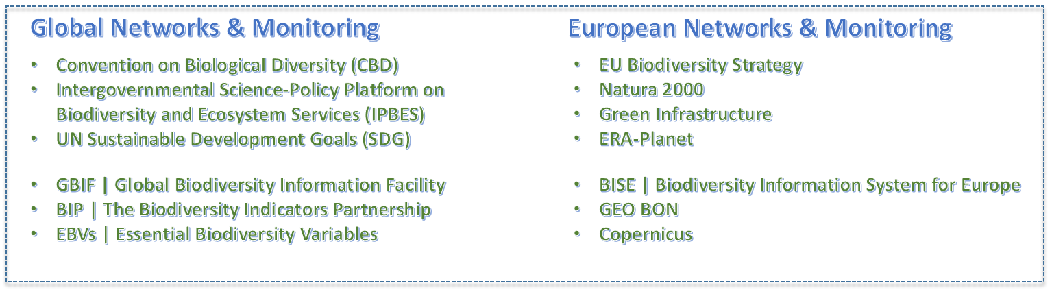
Global, European & national Earth observation networks
- Defining Indicators: Application of policy goals and allocation of essential variables.
- Implementing workflows: Model transfer into software and web applications.
- Contributing knowledge: Communication and implementation at administrative levels.
images & text by Dr. Carsten Neumann