
Mapping Calluna vulgaris Traits
Observing Drought Effects and Flowering Phenology from Drone Surveys
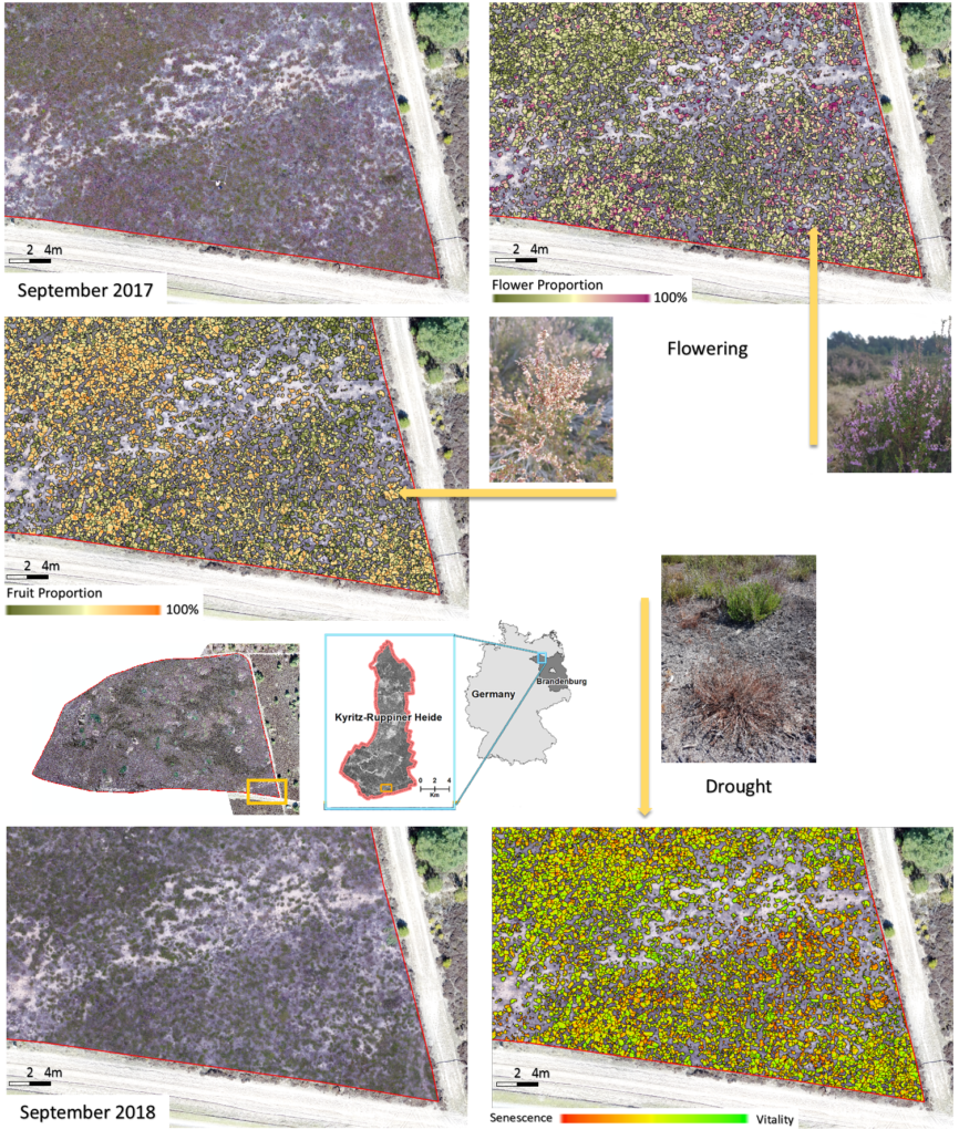
We developed an algorithm that is capable of delineating individual Calluna vulgaris plant units from simple RGB Drones (2 cm pixel resolution). We can further use the Calluna plant units to characterize the growth status and the plant trait development under varying climate conditions between the years 2017 and 2018. The algorithm was applied to different managed areas in the South of the Kyritz-Ruppiner Heide to evaluate the conservation status after mowing as well as after fire management (see visualization below)

In 2017, the heath was flowering intensively. The algorithms allows us to map the spatially heterogeneous distributions of flower and fruit proportions per plant unit. That way, we are able to visualize the phylogenetic diversity of individuals that are competing for pollinators. In 2018 after a drought period, flowering almost completely disappeared. Instead, we were able to observe the death of individuals due to a limitation in water resources. Thereby the vitality of a plant can directly be assessed using drone imagery.
images & text by Dr. Carsten Neumann


